A friend requested a map showing where we’d been. This is the best I can do on my phone. I hope it helps.
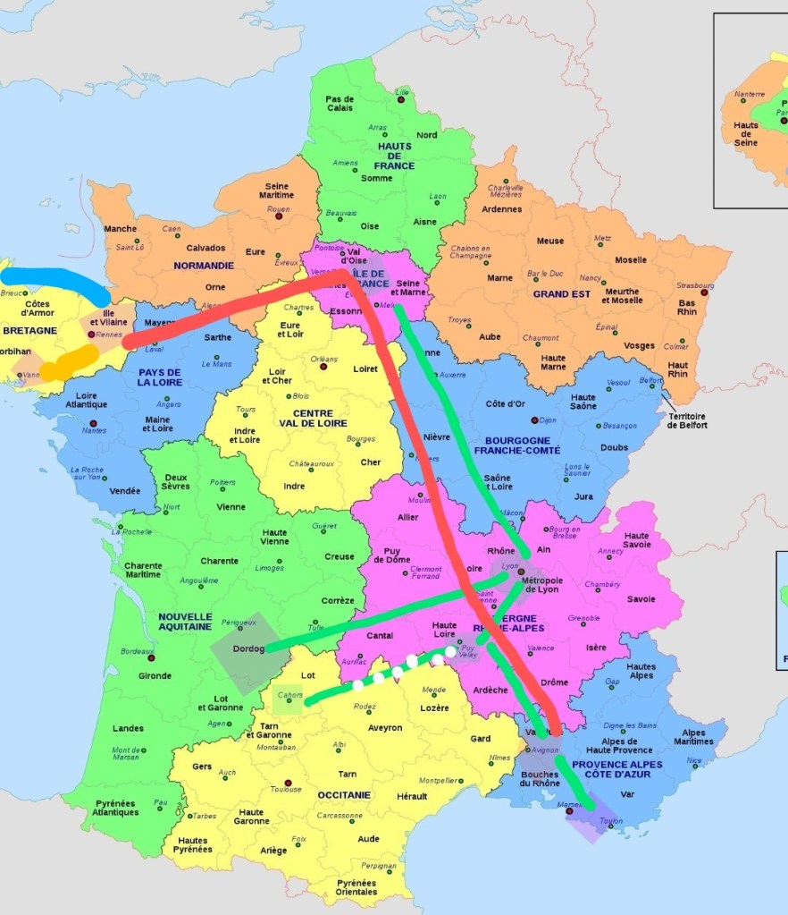
I bean by highlighting major areas, then adding lines to show routes. I like this map because it has the administrative regions of France. We were in 5 of the 13. I’m not counting Paris as that was just a flight base.
From Paris we took the TGV to Lyon in Auvergne Rhone-Alps, the long green line, north to south-east. From there, a green line to Le Puys en Velay in the same region. The green line with white dots from Le Puy shows our Chemin hike, mostly in the Occitanie region.
Also from Lyon, a green line to Dordogne, Nouvelle Aquitaine, – that long hot drive in a POS Fiât.
After the Chemin we made it back to Le Puy via van. From there a train to Avignon (highlighted) in Provence, where we rented a much better car, the Renault Clio to go to Isle Sur la Sorgue and other places. Then to La Ciotat, east of Marseilles (highlighted).
Back to Avignon to return the car. Then a long TGV from there to Paris to Rennes, Bretagne, – the long red line.
The blue line from Rennes indicates travel to the Cote d’Armor and St. Malo. Orange line from Rennes is to the Morbihan area. Have I already mentioned that Mor Bihan is the Breton word for Small Sea? Also learned recently at the Musée de Bretagne that cairn is a Breton word, meaning…small pile of stones.
I think that covers it.

Amazing
LikeLike