We’ll, I seriously thought no one would believe the fantastical yarn i published yesterday. However it appears I am better at fiction than I supposed.
We did not escape by the skin of our teeth, and we did not actually race from the helicopter to the terminal under small arms fire. I am not sure how that rumor got started, and i do not know which, if any, three letter agency arranged our departure, but i am nonetheless thankful that we are not in Mexico at the moment.
Let me know if any uncertainty remains on this matter.
This message is for our friends who knew we would be in Sayulita, Mexico, this week. We are home and safe.
When we got to our hotel on Tuesday there was no receptionist and a young man who was leaving let us in and helped us get settled
On Saturday he came to our door with a federal police officer and told us that the “stuff was going to hit the fan” and we needed to leave. He said there was room on the helicopter for two more people so he chose to give us the option. With trepidation we went along. I told him we needed to change our flights, and he said it had been y taken care of. I don’t know if we were on the last flight out, but smoke was starting to rise over Puerto Vallarta as we took off.
Oir “friend” said we were free to tell the story, but no one would believe it.
So in the alternative, we hated our hotel, the town was very noisy and expensive, we were not enjoying ourselves, so we left the day after getting there, to the concatenation of the TSA Agent at passport control who asked why we flew a thousand miles into Mexico to stay one day. I amb glad we had not taken the opportunity to refill our emergency prescriptions whilee we were there.
Whichever version you prefer, we are safe and did not encounter any of the violence that is currently in the news.
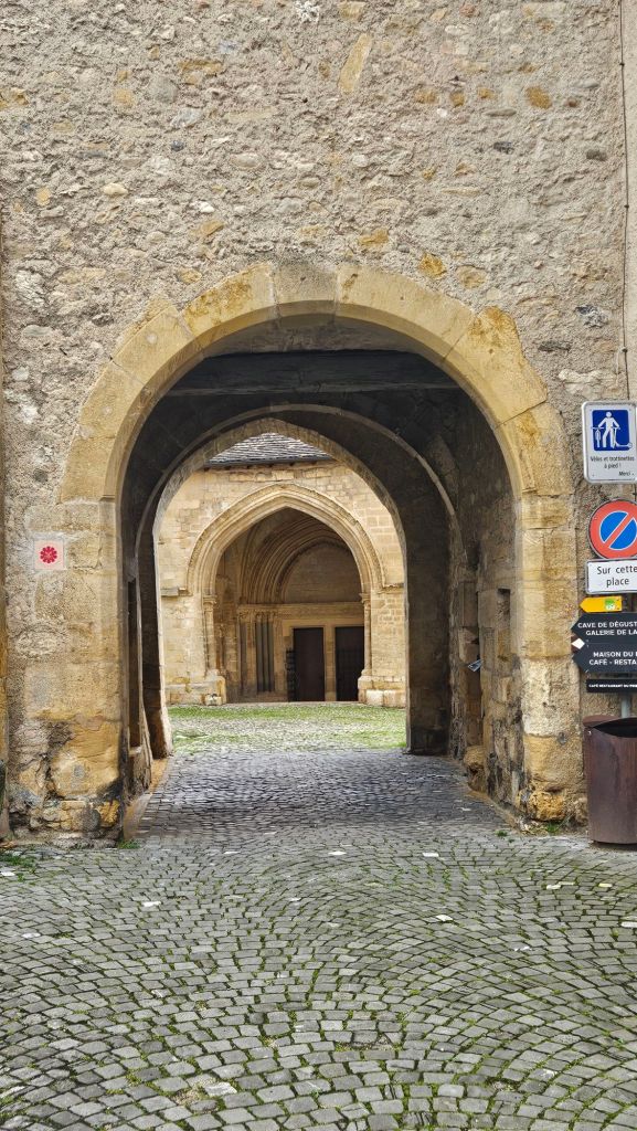
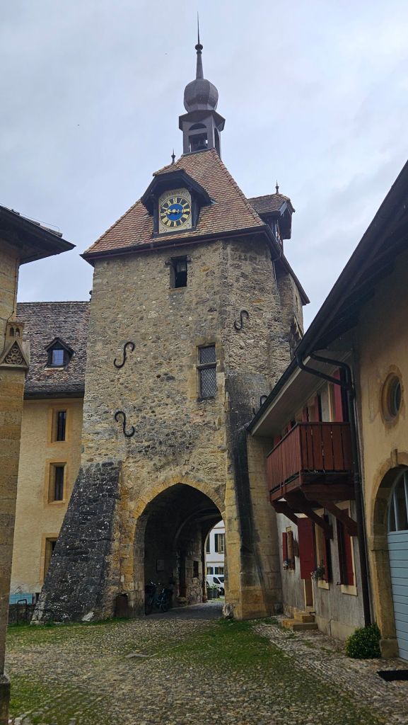
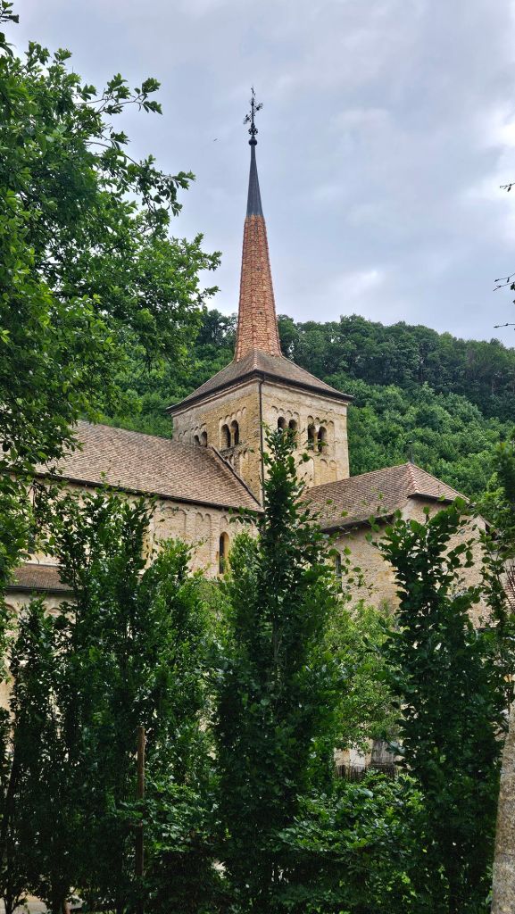
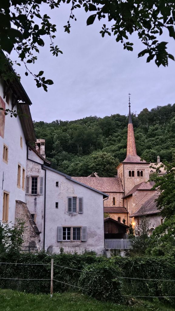
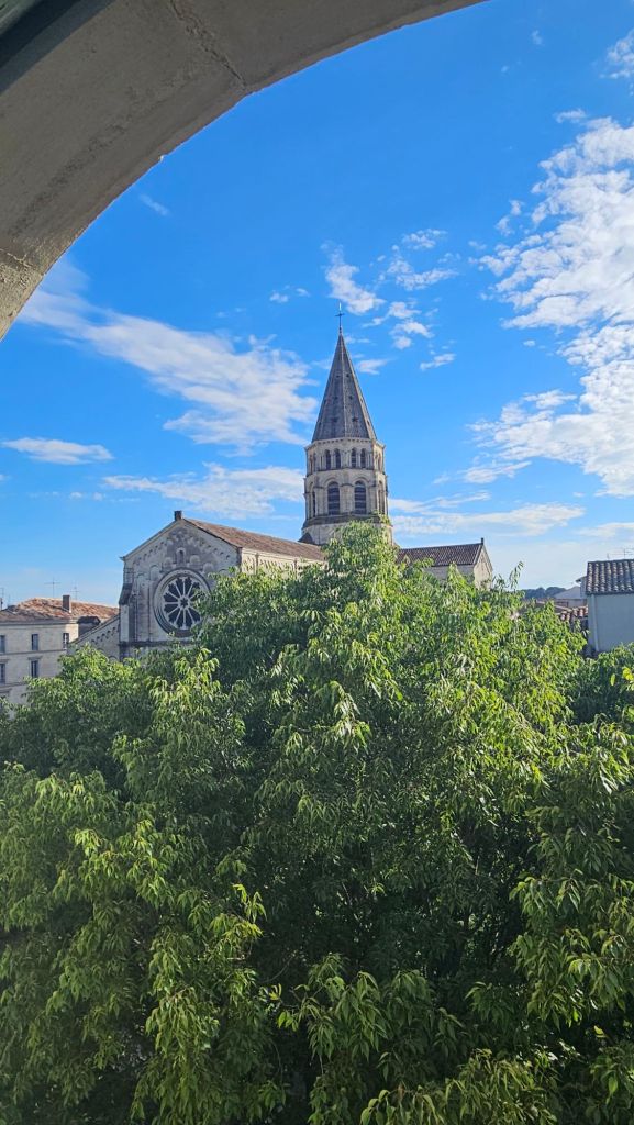
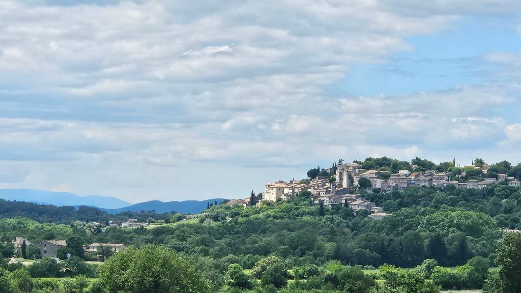
We are spending a few days in a very old and quaint Swiss village named Romainmotier. The village has evolved from its origin as the oldest monastery in Switzerland, founded in the mid to late 5th century CE, and has undergone many periods of growth, decline, and restoration. I have attached some links to the history of the village and the Abbey here and here.
I think it could be said that the village has survived its history, having been affected by both the Wars of Religion in the 16th century and the revolution against the secular authorities of Bern in the 18th. This is in the French speaking area of the country, and it seems there is some residual resentment regarding the period of German dominance. Of course, I may be wrong since I am only repeating a rumor.
We have been relaxing, walking, and avoiding the rain as best we can. We’ve taken a couple of day trips that we’ll address in another post. As a matter of fact, I am composing this post while e are traveling to Delemont for a special exhibition of a medieval illustrated Bible
The linked articles have some great pictures of Romainmontier, but I will nonetheless post a few of my own.
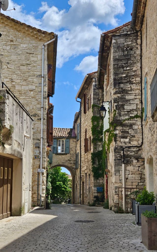
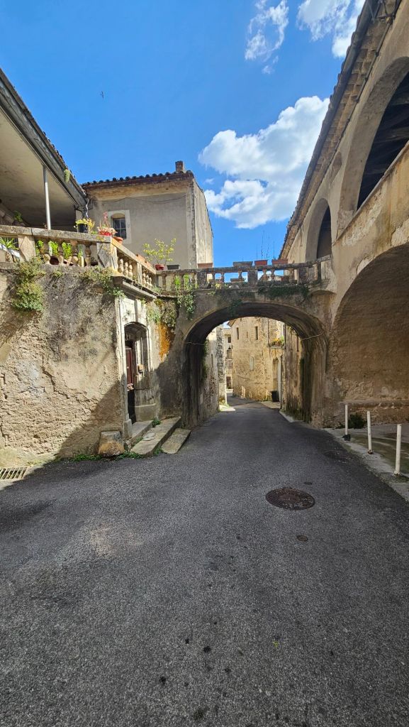
We arrived in Montpellier on Sunday, wandered the streets for a few hours until our apartment was available for check in. That is also what we did after we checked in, and for the next three days, except for Tuesday.
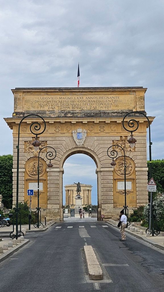
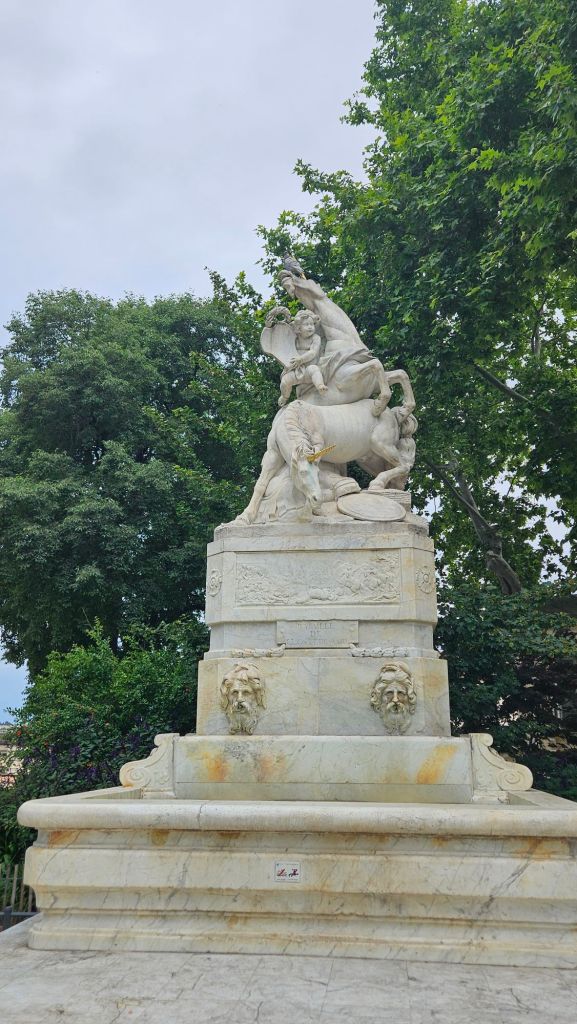
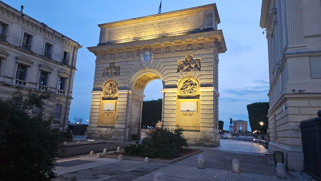
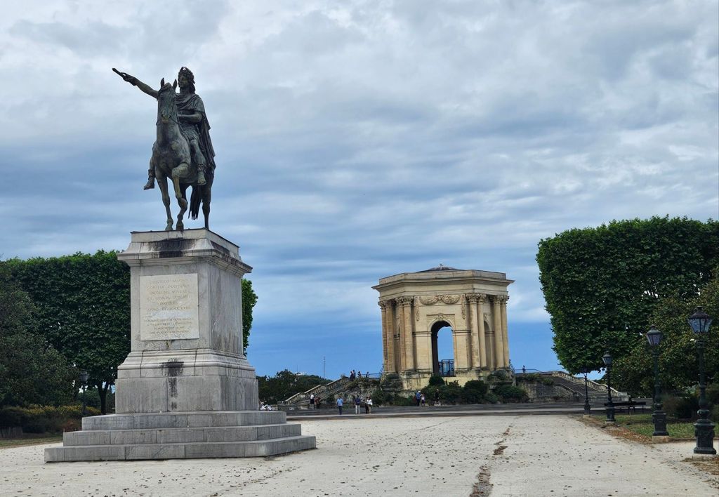
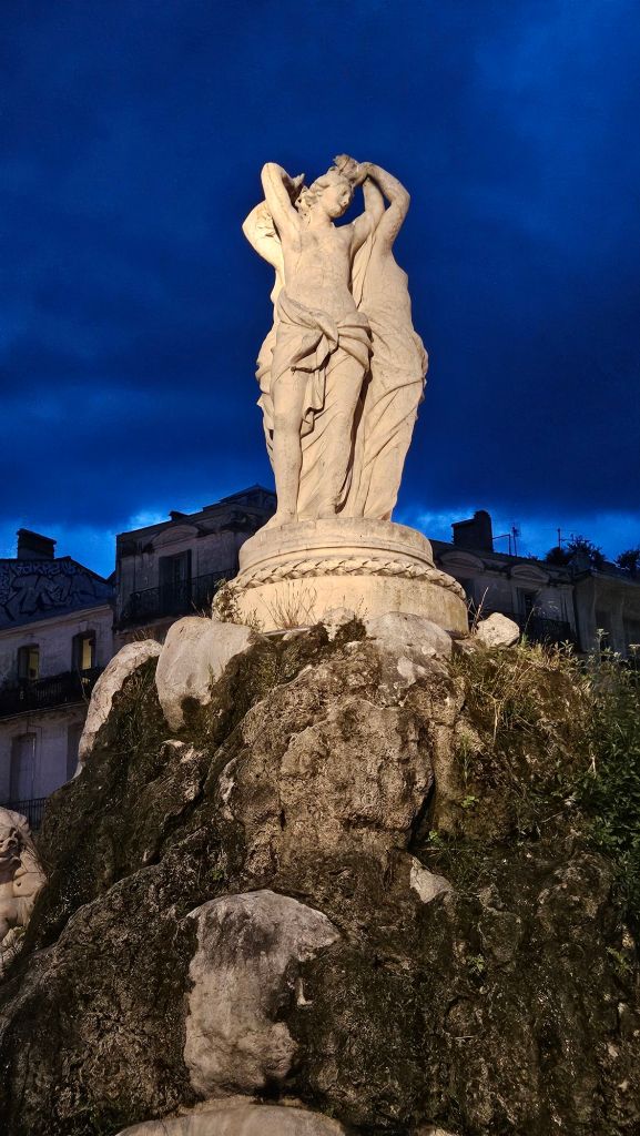
Arc de Triomph entering the Place Royale de PeyrouAn angel riding a lion.
This monument was at the entrance of Place Royale de Peyroy. I can’t find a reference for its context except a story that an Angel was riding a deer when the lion ate the deer and became the angels means of transport. I have no idea where that story arose.
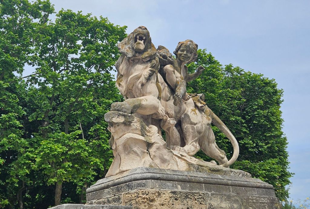
A monument to the Battle of Clostercamp
The Battle of Clostercamp was a defeat for the English in the Seven Year War, and although heroes were made that day, I can not find any explanation of the role of unicorns in the victory by French. I think perhaps this was a creative act of vandalism.
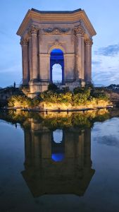
Arc de Triomh in the eveningPlace de Peyrou in the evening
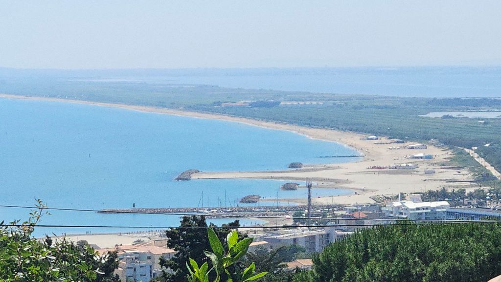
Tuesday was a clear day, and we decided it was the best last chance for Paula to swim in the Mediterranean on this trip. A short train ride, short bus ride, and long walk got us to a nice beach. I am not a beach person so I decided to take a walk. I had a professor in graduate school who said she didn’t “do” beach. I like that way of phrasing it.
If you look closely you can see Paula at the beachA bit of artistry with balance
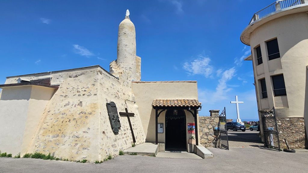
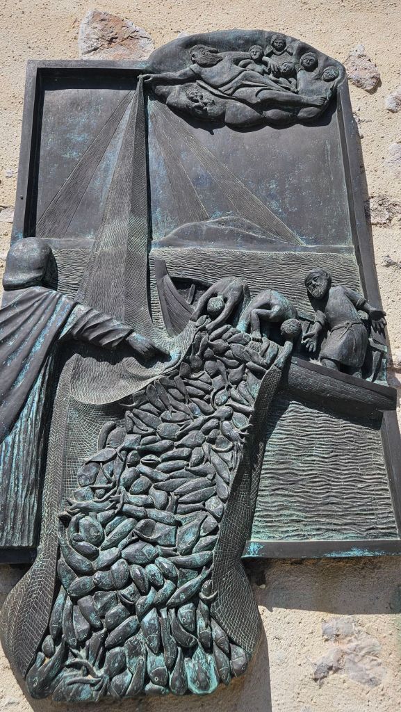
While Paula was enjoying the beach near Sète, I was “enjoying” a steep climb to the Chapel Notre Dame dle Salette, which was built in the 19th century for fishermen to worship prior to going out to sea. The hyperlink above provides some interesting information on this site.
Chapel Notre Dame de SaletteA prayer for a successful harvest
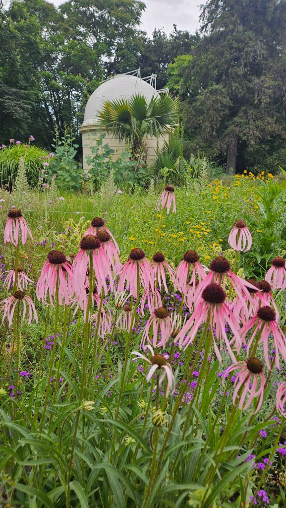
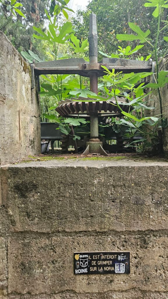
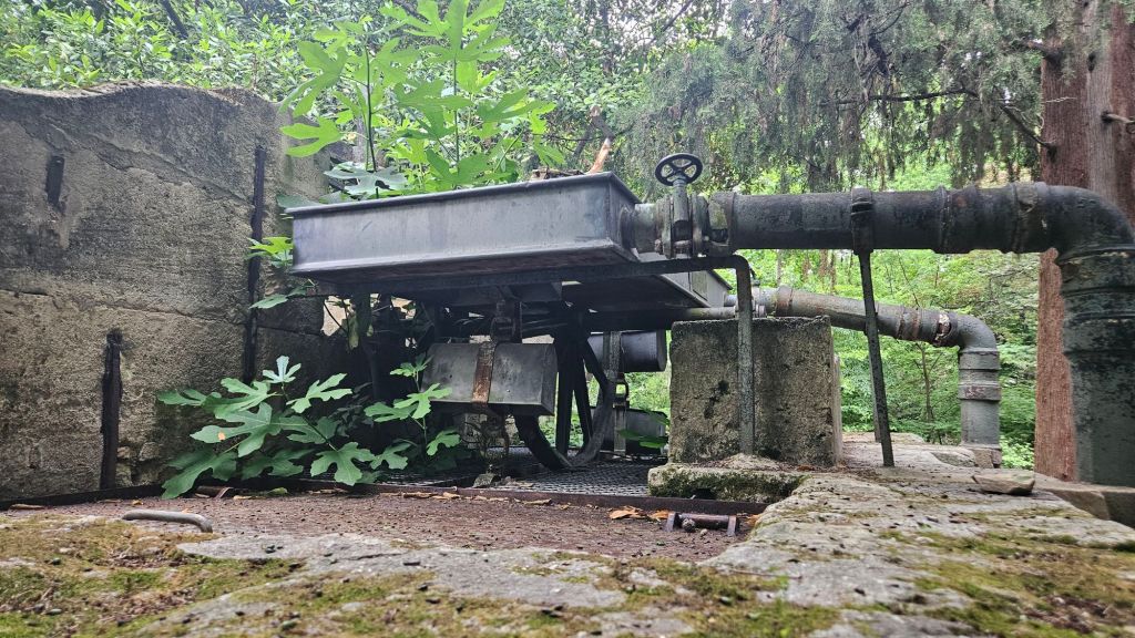
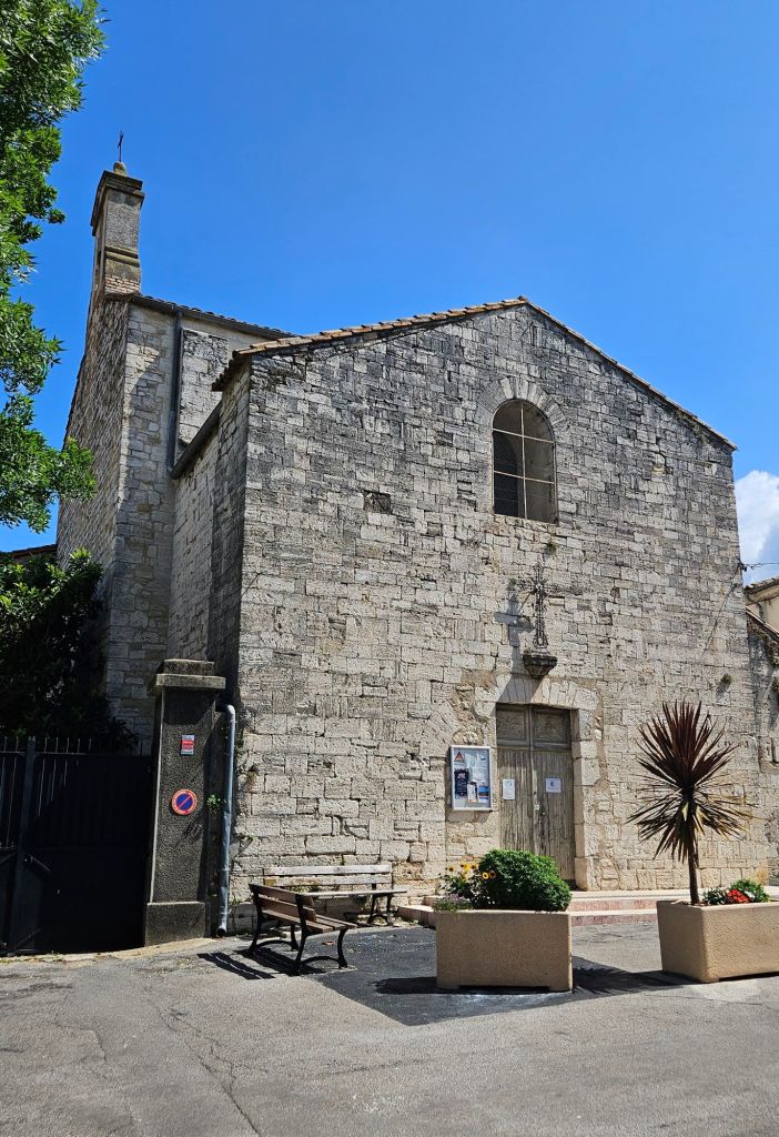
Wednesday was laundry day, and since it was raining, we stayed home for the morning. In the afternoon we went to the botanical garden. The garden was started by King Henri IV in the sixteenth century and is the oldest botanical garden in France.
An old irrigation pump that uses a bucket elevator to lift water from the wellGears for the pumpA view of a bucket. This tree is reportedly over 400 years old. People leave messages and prayers with the trunk. This is how the French get out of the rain
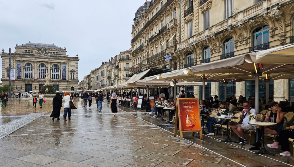
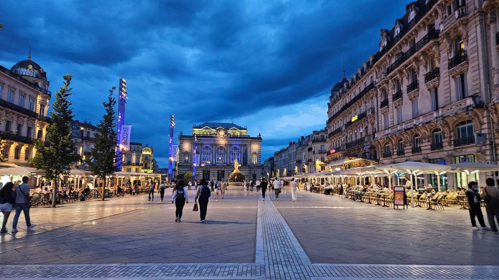
The Place de la Comedie is the place to go for drinks, sweets, meals, and people watching. The opera is in the background.
Place de la Comedie in the evening. Statue of the Three Grace’s, one of the symbols of Montpellier. It was installed in 1773.
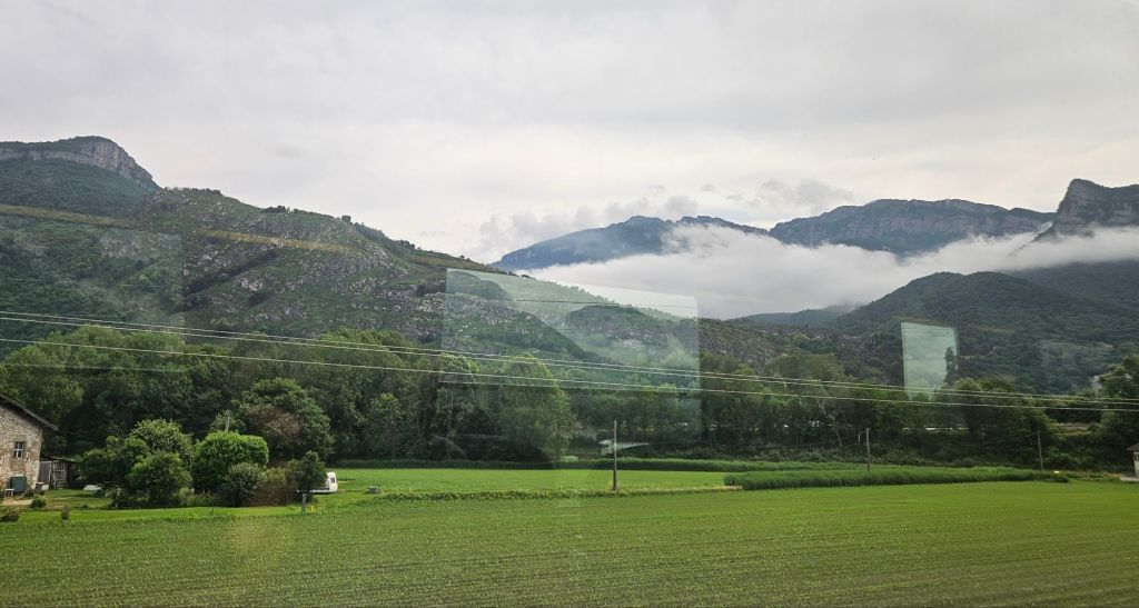
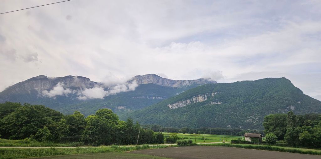
We are currently on a train headed towards Geneva, where we will spend a few nights visiting Paula’s friend. We are entering the Alpes west of Grenoble
Here is a photo or two from the train.
It’s time to stop writing and to start watching the scenery. Until later…..
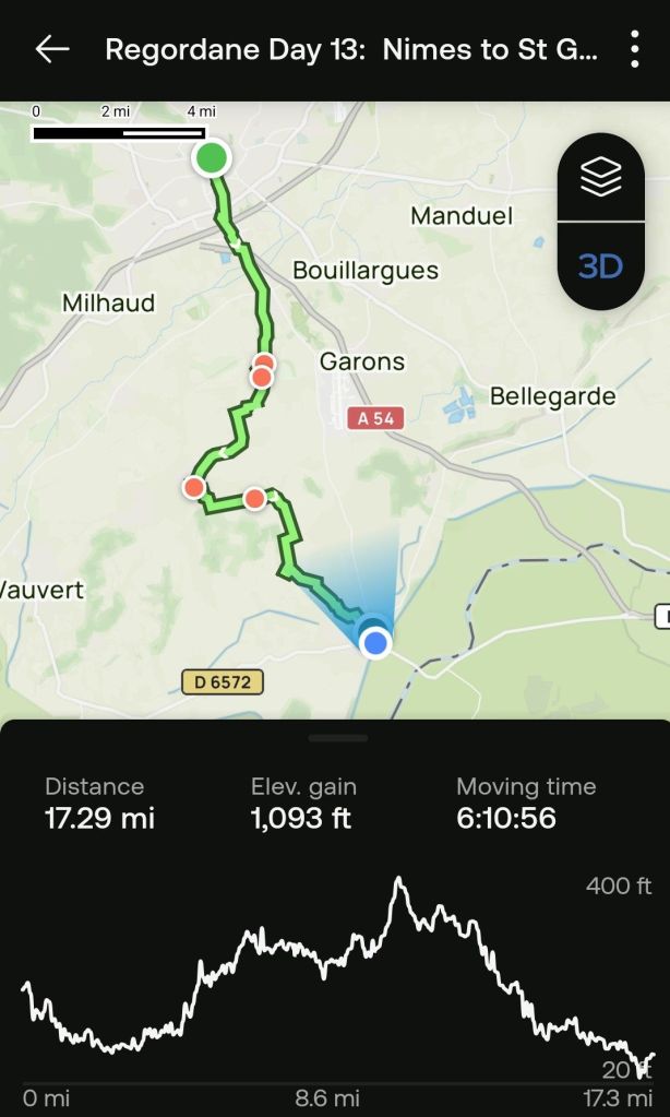
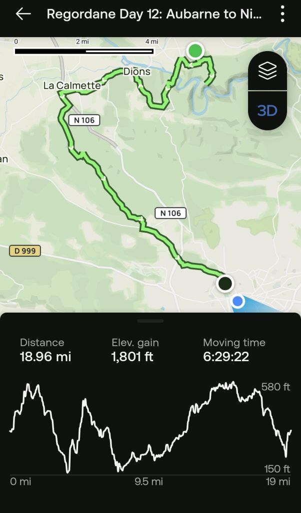
This will be a short post tonight. After two days of rest (which amounted to twenty miles of walking through Nimes checking out the various high points of the city), we headed off to complete our hike of the Chemin de St Gilles. We will catch up on the Nimes visit in the next few days.
The trail today was mostly (read almost all) on pavement. As for me, three was nothing of note on the trip except
It is the last stage of the Regordane, and
There was not a generator factory in Gènèrac.
New shoe insoles make a big difference when walking on pavement.
Paula will have a different perspective and will uploading her observations soon.
Here is today’s graphic.
Regordane Day 13, Nimes to Saint Gilles
If you wish to see the recap video, the link is here.
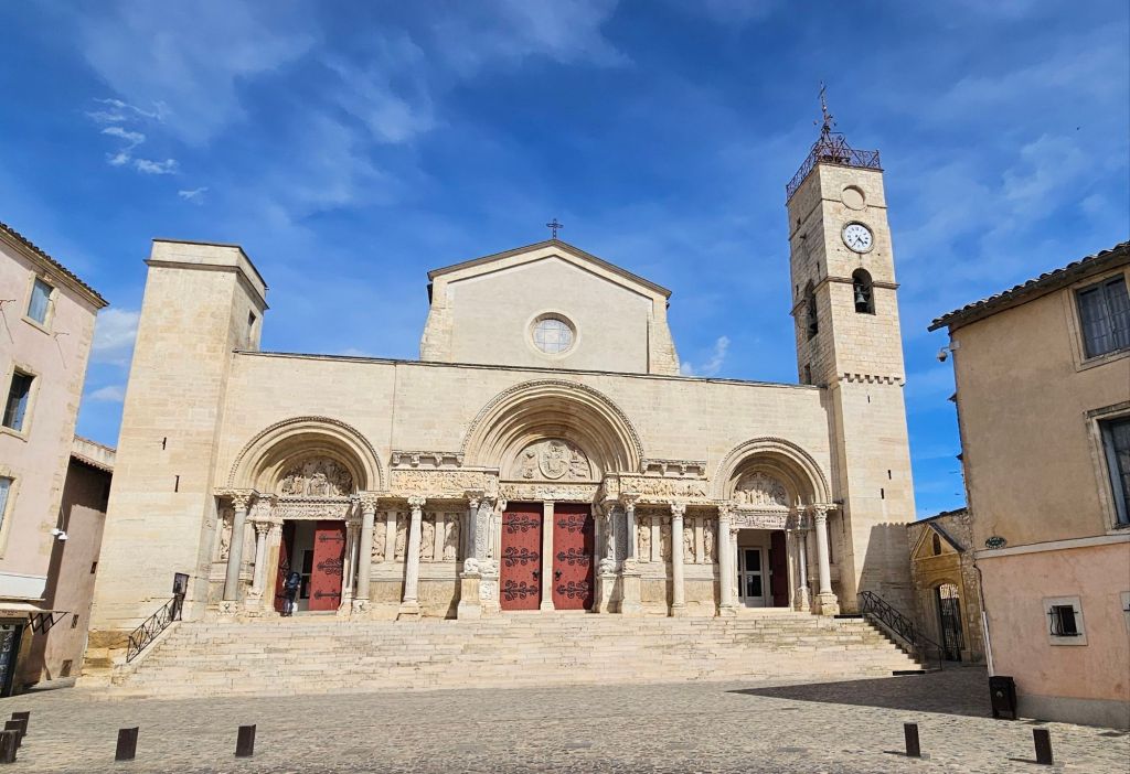
This is the endpoint of the Chemin, Abbatiale Saint-Gilles du Gard.
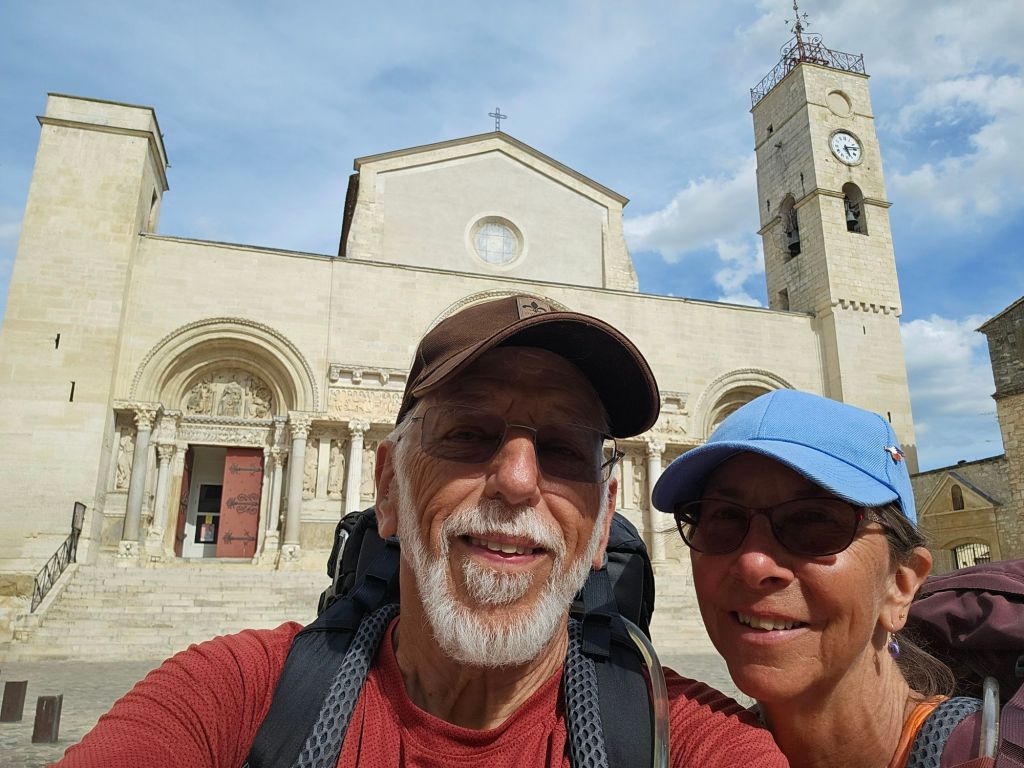
Here are a couple of happy, if not relieved, people marking their arrival at the Abbey.
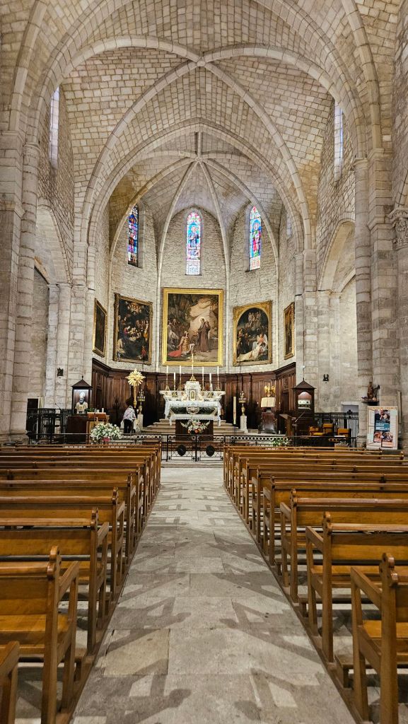
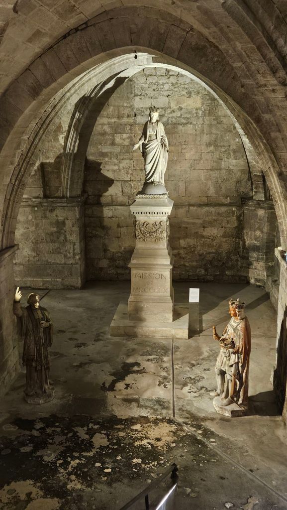
Inside the Eglise de Saint Gilles du GardThe entrance to the cryptThe sarcophagus of Saint Gilles
We celebrated the completion of our journey with another great meal at our hotel.
I was trying to get a photo of the scores of swallows flying around. Here is Paula very pleased with herself for successfully photo bombing the occasion. Yes, that is an umbrella hat, worn by all the fashion conscious pelerins.
Tomorrow, we head to Arles, which is thirteen miles away. However, the phrase “you can’t get there from here” is operative here. Tomorrow is the Fete de le Ascention, which is a big deal here so there is no public transportation available. if there was public transportation, it would take two hours and three modes to get there. We have been both encouraged to and dissuaded from walking there and we decided to pay 50 Euros for a taxi.
We will have more time for composing more stories tomorrow evening
Paula will be filling in the details for the day. I’m just going to blurt something and call it a day.
We arrived in Nimes limping and thankful for a couple recovery days to come.
Here is a photo from our air bnb that will be home until Wednesday.
We are in the historical center of Nimes, a block or so from some Roman ruins. We’ll post on such types of things over the next few days.
Here is the graphic for today.
It was a long, tedious day. It was hot in the sun. But we were blessed with some high clouds that provided some occasional cover and a cooling breeze that made the hike tolerable
If you’d like to view the recap video, here is the Link.
We are staying in a Chambre d’hōte in Aubarne being hosted by an African couple. Thierry was born in Algiers when it was a French department, and Catherine was born in the Belgian Congo. They are Frence as all get out. They are a fun couple, quite entertaining, and have kept is up until it’s almost bedtime.
The facility offers a very Spartan list of amenities, among which is:
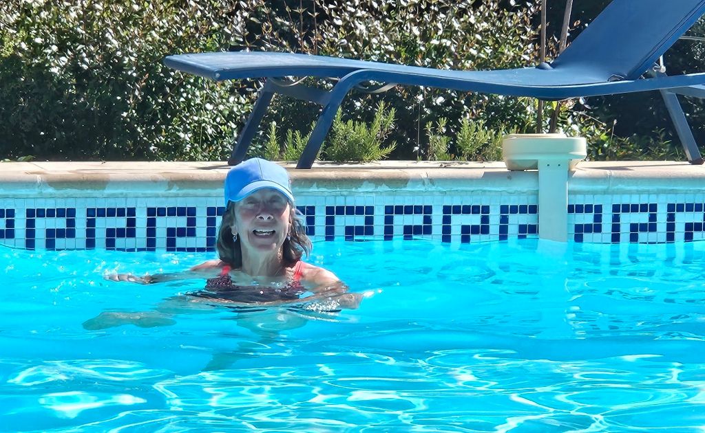
Paula resting after a full day of hiking
Tomorrow we walk to Nimes, which is about 18 miles. That’s the longest section we have on this trail, and the last section with significant elevation gain. We are taking two rest days in Nimes because we can.
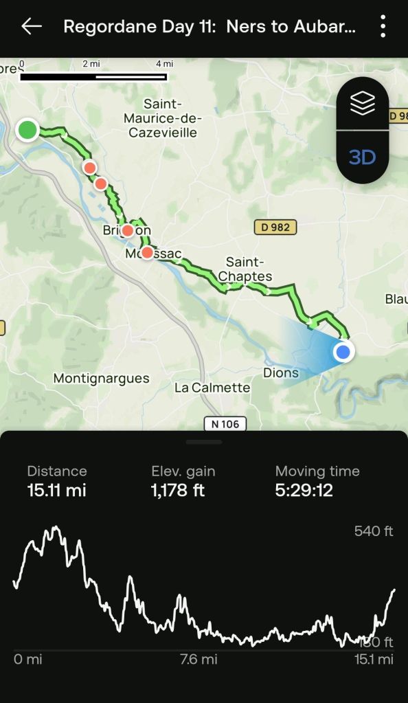
Today was a long day as well, mostly on pavement, through pastures, vineyards, and a few very old villages.
Here is the graphic for today.
Day 11: Ners to Aubarne
As you can see, I’m completely incompetent on judging what the day will bring. It was not as easy as I expected.
If you would like to see the recap video, the link is here.
A few of today’s sights:
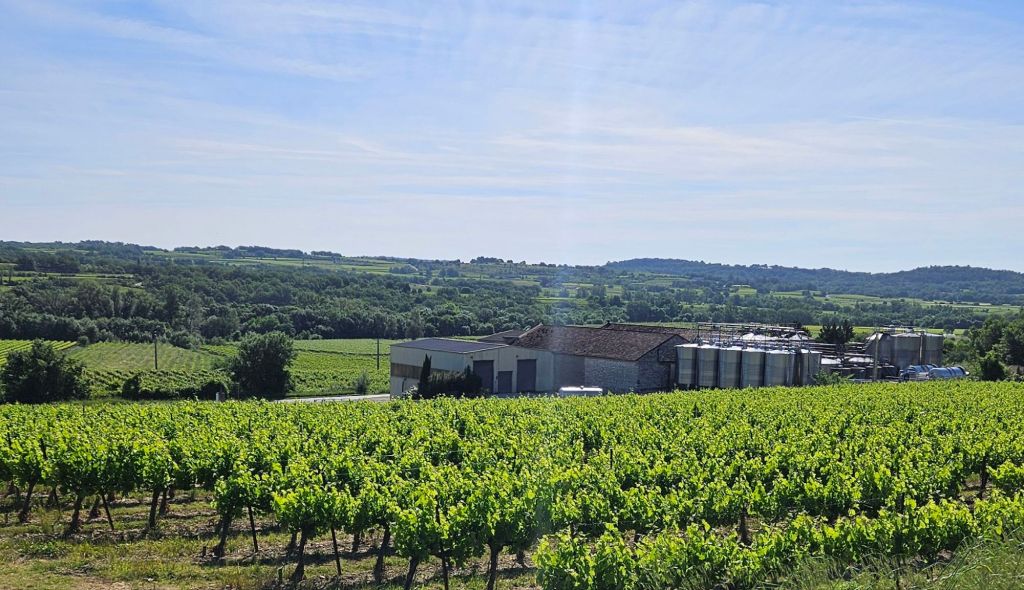
One of three large wineries we saw today.
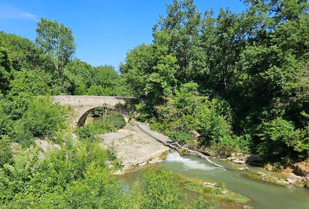
This bridge crosses the river from Moussac leads to the historical Regodane. It is a much longer hike to St Gilles, but with a greater paucity of accommodations.
Today has been a little too much walking, wine, and food. It’s time for bed.
Today was a fairly easy walk. The first five miles were on pavement, which was good since we didn’t have to clambor over rocks and roots, but a little hard on the feet. The waymarking was a bit shady in the afternoon, which got us off track a couple of times. Once, we ended up at an airplane landing strip and followed a trail in the right direction until we merged back with the Regodane. The second time, we got stuck in a barley field with no apparent way when a hedgerow crossed the trail, and we had to find a way around it. We finally got to a road but then had to find a way across a deep ditch.
Through impressive use of our powers of observation (which had earlier lapsed, getting us into the situation) we prevailed. We actually ended up with a net saving of 0.5 kilometers from the official distance.
Here is today’s graphic.
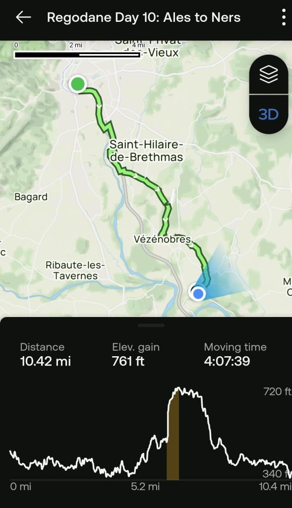
Day 10
The elevation profile chart looks formidable, but it wasn’t that bad. The tracking app turned itself off a couple times, which compressed the horizontal axis a bit. If you wish to view the recap video, click this link.
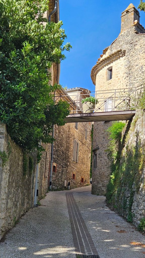
The highlight of the day was walking through the village of Vézénobres, which is a medieval fortress city, and was an important stop along the Regordane and the Chemin de Saint Gilles.
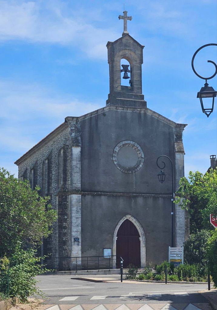
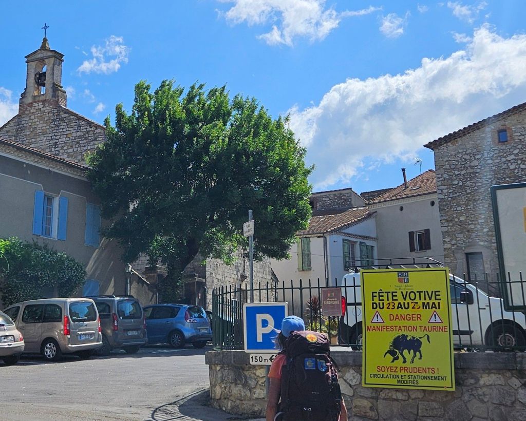
We took a long break at Saint Hilaire de Brethmas as we rested our weary feet. Our bench was in the shade, right across from the town church.
The door was locked, as have been many of the Catholic churches in the Cevennes. I think they still don’t trust those Huguenots to not burn them down, given the chance.
We are missing the festival in Saint Hilaire that is happening today and tomorrow, featuring the “manifestation” of the bulls.
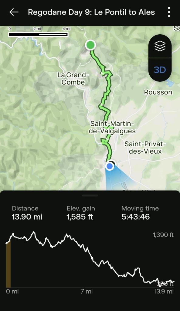
Someday I will remember that reality has plans of its own. Yesterday I was confident that today’s hike would be a simple matter, featuring a nearly one thousand foot drop in elevation over a moderately long trek. I was certainly in for a surprise. Nested been the two end points of today’s hike was over 1500 feet in elevation gains.
Here is the graphic for today.
Day 9
If you would like to view the replay, it can be found here.
In addition to misjudging the elevation profile, I also misjudged the accuracy of the AllTrails map. Apparently, since the Alltrail map was generated, the group that maintains the Grand Randanné has made significant changes to the GR700 as it approaches the Ales metropolitan area. While in the middle of a forest where the waymarking was a bit vague, I trusted the AllTrails map guide to resolve an inconsistency and we ended up in an area where the we were separated from the trail by a fence, and there were no waymarkings to follow. Fortunately, there are plenty of trails that can be located on Google Maps, so we eventually found ourselves and the official trail. I guess it is adventures like this that keep us traveling.
We had considered taking a rest day tomorrow in Alès, but we did a ChatGPT query, asking whether there is any good reason to spend a few days in Alès and Chat said, “Meh!.” Actually, I need to correct the record, since Paula is averse to me taking license in my stories. We did not queriy ChatGPT. We got that information from Wikipedia. However, we will be taking a couple days off in Nimes starting on Monday. We understand it is a beautiful city with a rich heritage.
Here are a few photos from the day.
Shootings the path is overgrownAlès is in the far background
I would have added pictures from the time we we were wandering in the forest, but we didn’t know where we were.
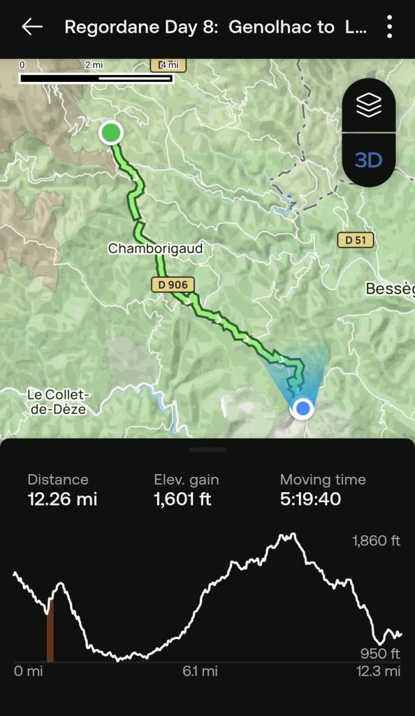
At least for this trip. Todaìy we reached both the halfway point on the Regodane and the last long climb before leaving the mountains. We are now heading downhill into the Mediterranean climate zone. Here is the updated chart.
DAY 8: Génolhac to Le Pontil
If you would like to see the virtual trail video clip, click this link.
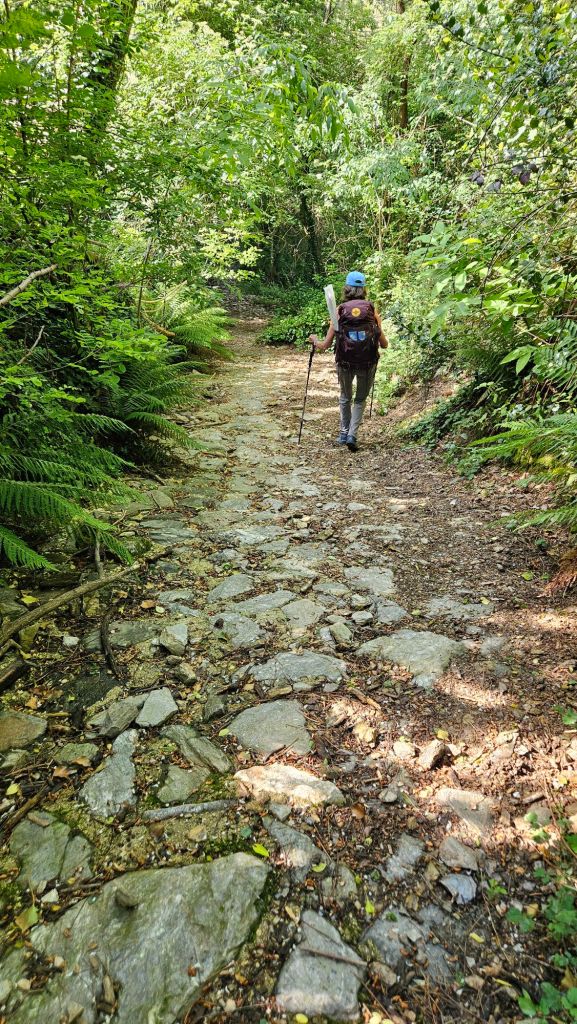
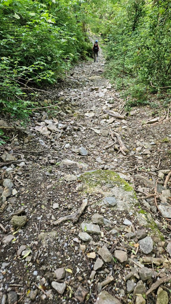
A section of ancient road. A more typical path
The Regordane was a mercantile route for several centuries. At one time, they hauled material using carts, and as the roads degraded, they began using donkeys. That practice continued until the 19th century and train lines were created. There are a number of sections that appear to have been roads, but those sections are interspersed with rocky terrain that is sometimes nearly impassable.
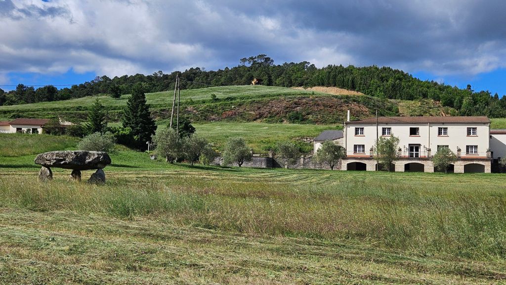
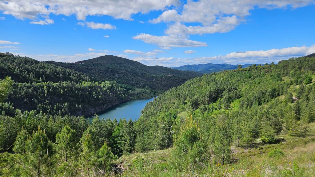
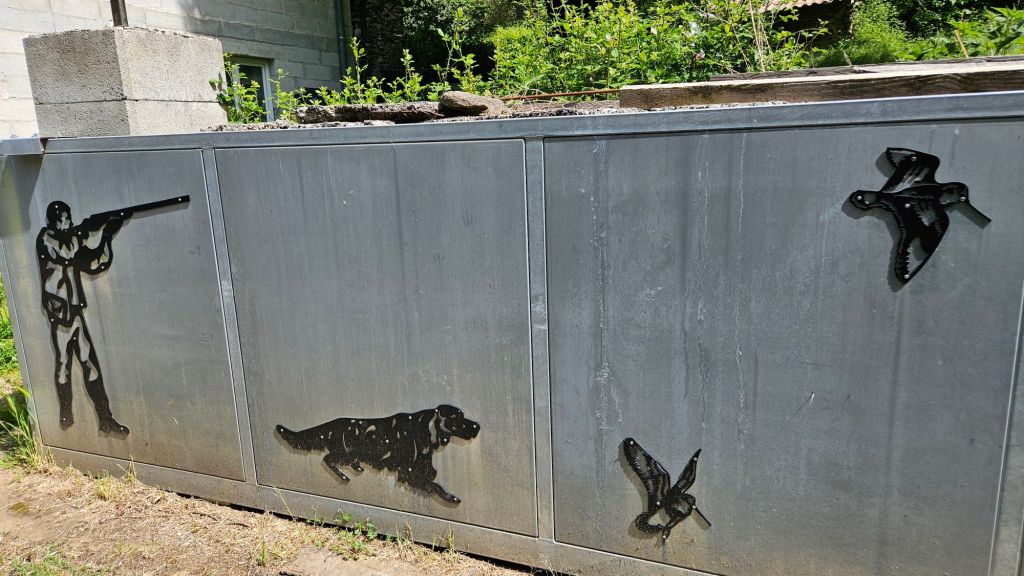
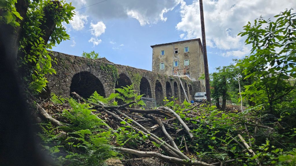
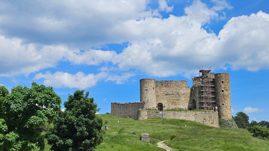
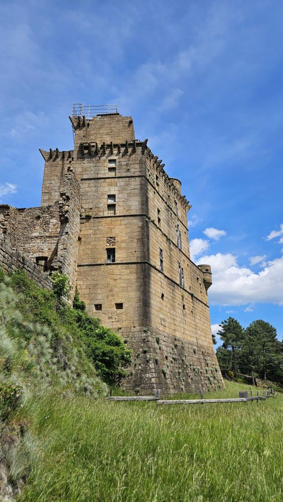
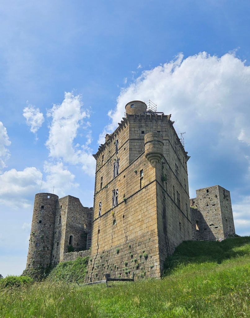
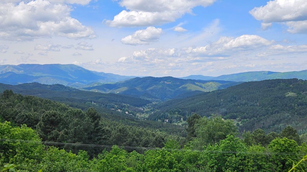
The humming birds here are enormous. Hunters hunt them with shotguns and send dogs to retrieve them. This is the remains of a coal mining operation, with a long ramp used to move the coal to the rail line several miles awayThe chateau in Portes is currently being restoredThe trail passes right next to the chateau.This particular castle was designed specifically to move horizontally and vertically like a ship through a waterboard. (Hint: that’s a lame chess joke inspired by the similarity of the corner to the prow of a ship.) I can explain further, if needed. A view of the area of the Cevennes we passed through the last few days. This photo was taken as we reached Portes.
I actually felt a bit sad seeing these mountains for the last time in this journey. Tomorrow we will hike to Alès (formerly spelled Alais) as we continue to drop in elevation to near sea level. It will be warmer and start becoming more densely populated as we approach the Mediterranean coast.