This post is by Charlie
Tomorrow we leave Conques for part 2 of our Chemin de Saint Jacques. When I look at the elevation profile for our morning walk, I see this:
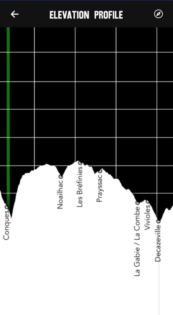
After fretting about it for a bit I realized that the scales on the graph create a misleading impression. Although we will climb about 350 meters in the first 5 kilometers it won’t be the near vertical trek as it appears in the diagram.
Retrieving some basic trigonometry from the dust bin of my brain, I determined that the horizontal axis can be considered the measure of a hypotenuse, and the slope of the ascent can be determined using a sine function. The steepest part accordingly will average about 8° with an overall average for the initial climb of about 5°. (I used a different map to get a more accurate estimate of distance and elevation)
Looks like we won’t be needing pitons and rope after all.

I hope it’s a beautiful hike! And glad you won’t have to practice your free-climbing skills!
LikeLike
What a scientific analysis, Charlie! Fun to read. And glad you won’t need pitons and rope. LOL
LikeLike